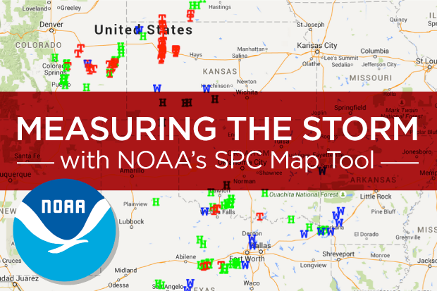
When destructive storms occur, understanding the extent of the damage and where it occurred can help expedite the resolution of claims following a storm. The NOAA Storm Prediction Center / Storm Reports details tornado, hail and wind storms on Google maps—pinpointing the exact location and time of recorded events. This tool is free and provides additional insight when investigating weather related claims.
When visiting the site, www.spc.noaa.gov/climo, you have the option of viewing the most recent storm reports by simply clicking on the map image, or you can view past storm events by entering the date (YYMMDD) further down the page. The data provided gives a clear picture of what type of damage was caused and the path the storm took. When viewing the SPC Map, you can get a more comprehensive picture by clicking ‘Google Maps’ at the top of the map as shown below. The Google map enables you to zoom in on the data recorded along the path of the storm.
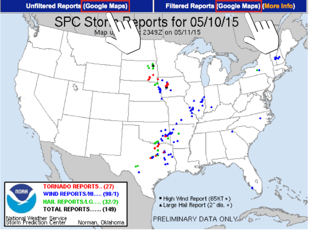
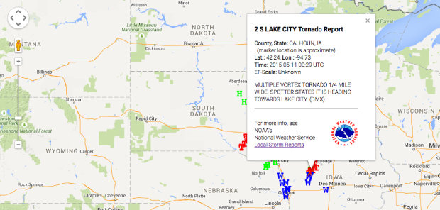
Every marker (W/Wind; T/Tornado; H/Hail) provides details that were spotted and recorded, from the size of the hail to the destruction caused by the storm. The following shows details about a Tornado that occurred recently in Iowa.
From discovering the exact location of where a tornado touched down, to reporting the size of fallen hail and wind speed, this helpful resource enables adjusters to more accurately assess and process claims following a severe storm.
Here are steps to help you utilize the NOAA Storm Reporting map tool:
- Visit: spc.noaa.gov/climo (we suggest bookmarking this page for easy access)
- Either click on one of the maps under ‘Current Severe Weather Reports’; OR
enter the date (YYMMDD) of a past storm under ‘Storm Report for Past Days’ and click ‘Get Data’ - The next map page gives an overview of all events across the U.S.
- You can download Filtered Tornado, Hail and Wind Reports in Excel format by simply clicking ‘CSV’ in the header rows above the recorded data.
- To zoom in on the map for detailed data, click ‘Google Maps’ above the map image.
- When viewing the Google Map, use Google’s slider tool on the left to zoom in to a specific area.
- Click the markers (W/Wind; T/Tornado; H/Hail) for detailed data to pop up.
This tool allows Hausch & Company to see the full scope of damage and results from any given storm on any given day. By knowing the size of the hail or the direction of a tornado, we arm ourselves with the knowledge to quickly respond to affected areas and speed up the claims process. With the capabilities to search by specific city, date and type of storm, we are constantly aware of the most recent weather related incidents and are able to respond quickly.
With offices throughout the Midwest including Chicago, the Quad Cities, Des Moines, St. Louis, Kansas City and Omaha, we are dedicated to simplifying your needs by getting boots on the ground anywhere you need us at anytime.